The Westford Town Lands is comprised of two parcels of town-owned land on either side of Brookside Road in Westford.  The Maple Shade Town Forest was acquired by the town in 2018, with funding from a variety of sources, including the Vermont Housing and Conservation Board and the US Forest Service. Misty Meadow Trails and Forest was acquired by the town in several parcels, at several different times.

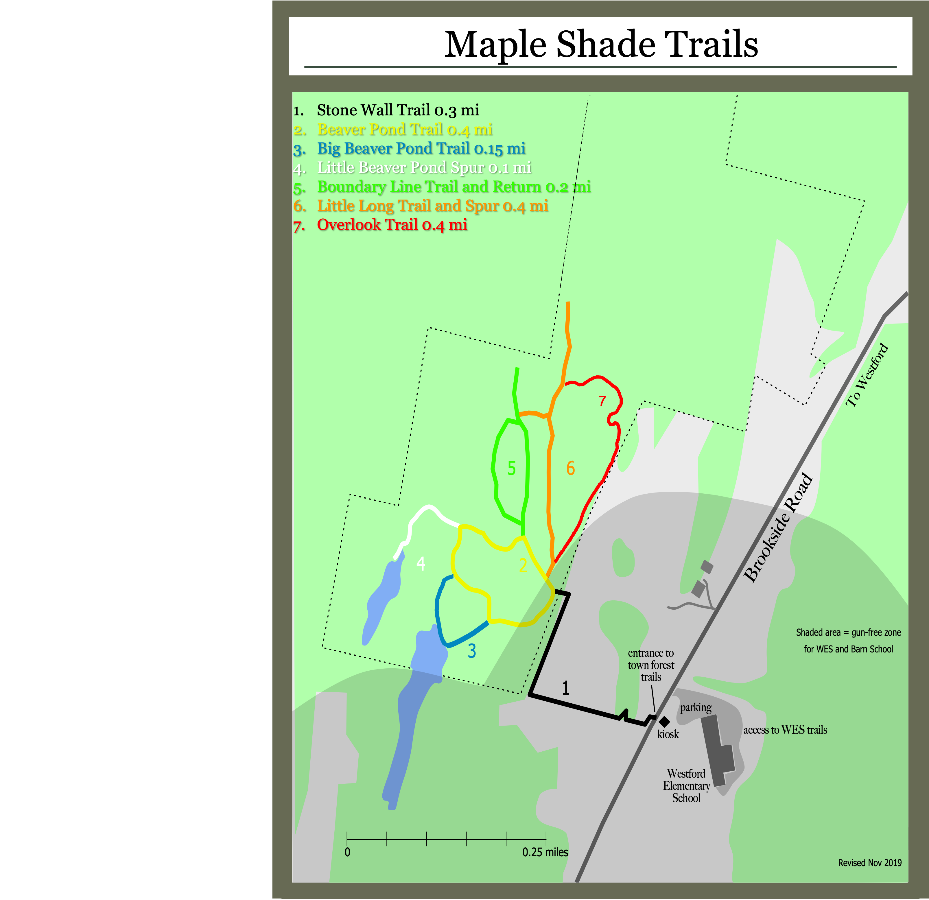
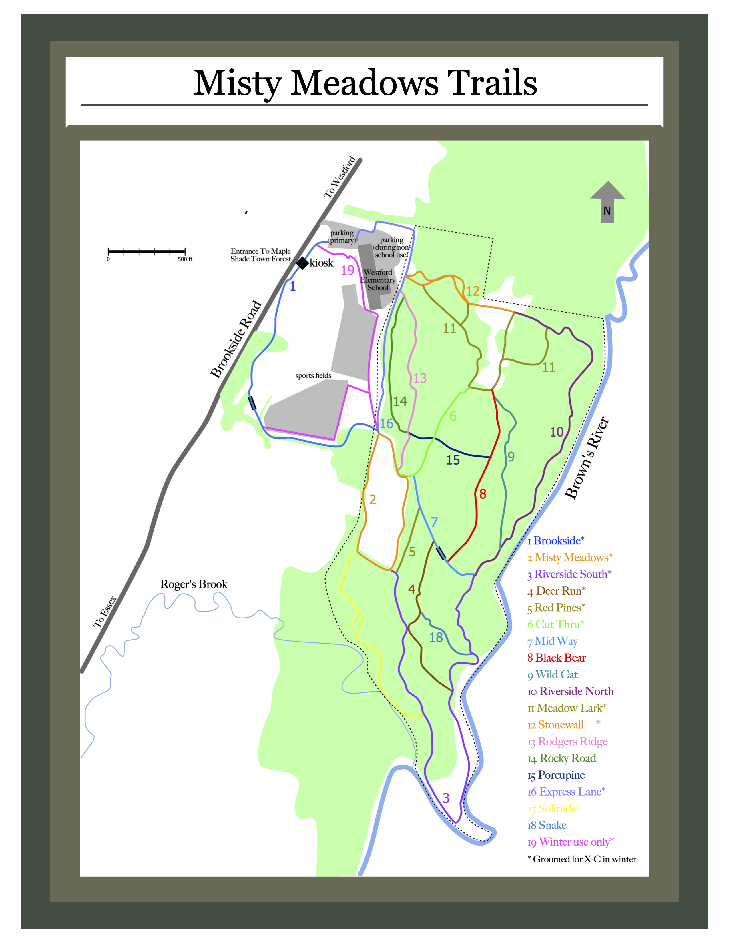
While the Maple Shade Town Forest and Misty Meadow Trails and Forest are two different parcels with distinct histories, established uses and easement restrictions, it makes sense to engage in a management planning process that will produce a long-term management plan for both. We are calling the unit comprising both of these parcels the Westford Town Lands. The goal of the Westford Town Lands Management Plan is to create a document that provides a robust framework for stewardship decisions in the Maple Shade Town Forest, including goals, objectives, action items and allowed uses.


Westford Town Lands  –  Long Term Management Plan (2019)


Maps:

Maple Shade Town Forest Map  

Misty Meadows Trail & Forest Map

Westford Town Lands – Gun Free Zone Map  

Westford Trails Map


A group of Westford residents hike the Jackson Farm & Forest property prior to its inclusion into the Town Lands


Does a trail need maintenance? Contact our Conservation Commission